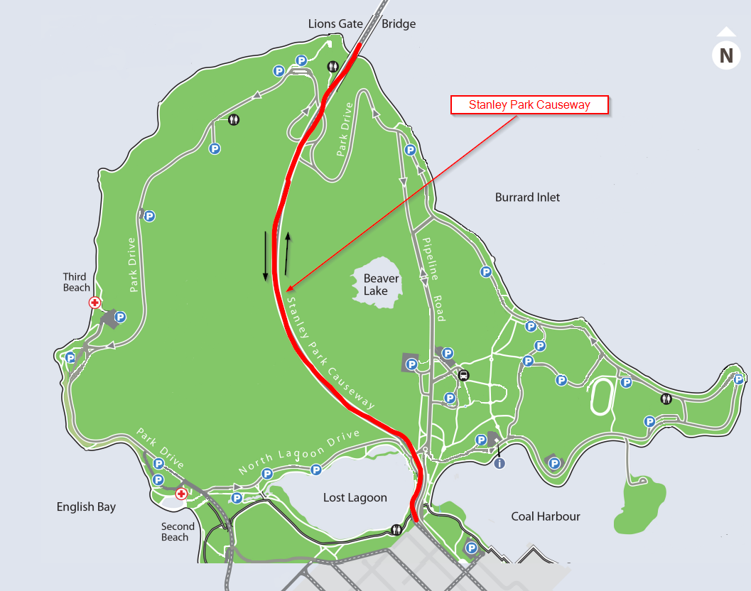
Stanley Park Causeway in Vancouver, BC, Canada
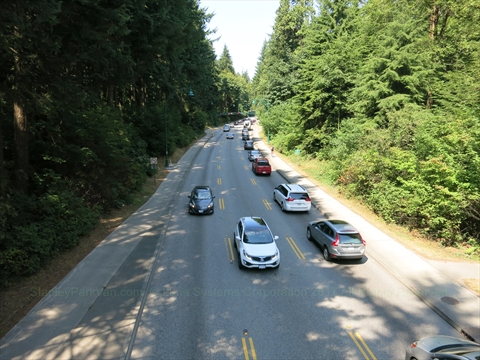
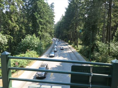
The Stanley Park Causeway is a high-volume, 3-lane commuter highway running north-south directly through the forested core of Stanley Park.
Constructed between 1916 and 1926, the causeway fundamentally transformed the geography of the park, effectively creating Lost Lagoon by completely landlocking it and cutting off its natural tidal flow from Coal Harbour.
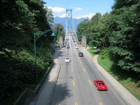
Today, the highway functions as the primary vehicle transit pipeline connecting downtown Vancouver to the Lions Gate Bridge, North Vancouver, West Vancouver, and the Sea-to-Sky corridor.
Counter-Flow Lane System:
To safely manage traffic volumes during intense morning and afternoon rush hours, a dynamic counter-flow system alternates the direction of the center lane. Because of this structural scheduling, motorists should routinely expect to have only one lane of open traffic in their direction of travel.
Navigating the Causeway
Northbound (Downtown to North Shore)
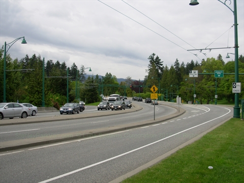
As you leave downtown Vancouver, West Georgia Street directly feeds into the entrance of the Stanley Park Causeway.
The Internal Slip-Lane: The single alternative entry point from inside the park loops up from Stanley Park Drive near Prospect Point. Crucially, this merge gate is strictly closed from 3:30 PM to 6:30 PM on weekdays. Merging here is highly challenging during peak traffic blocks.
Emergency Escape Exit: If you join the northbound Causeway by mistake, there is exactly one exit lane positioned just before the bridge deck structure. Taking this ramp drops you onto Stanley Park Drive, forcing you to navigate the long western loop around the outer shoreline cliffs to return toward English Bay.
Southbound (North Shore to Downtown)
On-ramps from Marine Drive feed vehicles onto the bridge deck, directly connecting south straight into the Causeway alignment.
West Side Attractions Exit: Immediately after crossing the bridge threshold into the park, there is one fast exit ramp leading to Stanley Park Drive. Motorists must use this lane if they wish to reach the western recreational landmarks, including Prospect Point, the Prospect Point Picnic Area, Hollow Tree, Third Beach, the Teahouse Restaurant, Second Beach Pool, Second Beach, or the playgrounds of Ceperley Park.
If you miss this single turnoff point, the highway boundaries will carry your vehicle directly out of the park zone, ending straight onto West Georgia Street downtown.
Safety Infrastructure Note: The safety configurations alongside the lanes include structural steel mesh safety fencing to strictly isolate vehicle traffic. Bike lanes and pedestrian footpaths are completely separated, widened, and clearly marked to avoid user conflicts along the multi-use commuter trails.
Stanley Park Causeway Map
Photos of the Causeway