8 Roads in Stanley Park in Stanley Park, Vancouver, BC, Canada
Surprisingly, there are only 8 roads in Stanley Park despite the park's massive 405-hectare total footprint.
The transit network fundamentally breaks down into one primary perimeter loop road (Stanley Park Drive), one major central commuter highway cutting straight across the core (Stanley Park Causeway), and six auxiliary service roads providing navigation into specific local landmarks (Pipeline Road, Avison Way, Lagoon Drive, North Lagoon Drive, Park Lane, and Rose Garden Lane).
This comprehensive driving guide breaks down each road alignment, detailing vital access rules, Road Closures, and park Parking logistics.
Road Closures
Temporary structural locks routinely alter seasonal driving access to prioritize high-capacity running events and major civic festivals.
View Active Closures ScheduleParking Rules
All parking locations throughout the grounds function strictly under paid validation models. There is no free parking anywhere.
View Parking Rates & Lots MapLions Gate Access
The central Causeway links downtown straight across the bridge 24/7. However, the internal merging slip-lane exit looping off Stanley Park Drive onto the Causeway is restricted and closed weekdays from 3:30 PM to 6:30 PM.
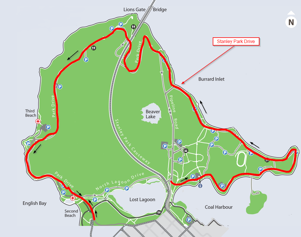
1 Stanley Park Drive
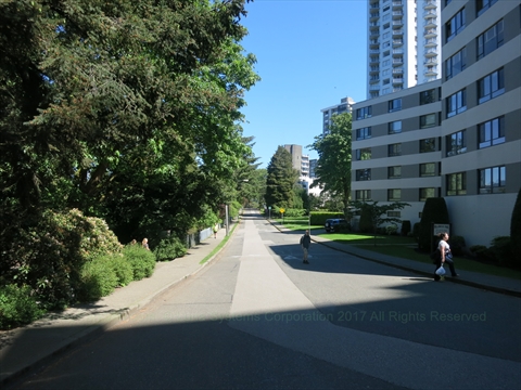
Stanley Park Drive acts as the principal arterial corridor of the park, framing the entire outer shoreline perimeter loop.
The road design runs strictly as a one-way path moving in a continuous counter-clockwise direction. The singular structural exception occurs along a brief baseline run connecting Beach Avenue up to North Lagoon Drive, where lane configurations move clockwise to safely buffer the localized Ceperley Park multi-use lane structures.
This is the essential route utilized by visitors looking to explore key tourist highlights from their vehicle. Driving this loop grants instant curbside access to iconic landmarks including the Queen Victoria Memorial, Harry Jerome Statue, the historic tip at Brockton Point, the marine marker at Chehalis Cross Memorial, the woodcarvings of the SS Empress of Japan Figurehead, the coastal clearings around Lumbermens' Arch, the family grounds at Variety Kids Water Park, the towering peak views at Prospect Point, the preservation site of the Hollow Tree, and the seaside fields of Ceperley Park.
Access: Cars can securely pull onto the loop corridor via either the primary downtown West Georgia Street gateway or the neighborhood Beach Avenue entrance lines.
2 Stanley Park Causeway
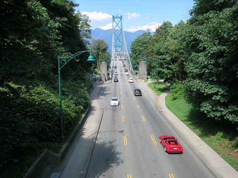
The Stanley Park Causeway operates as a high-volume provincially aligned multi-lane commuter highway, splitting directly down the geographic spine of the park layout to feed express regional traffic onto the Lions Gate Bridge heading toward North and West Vancouver.
This arterial route experiences severe congestion during weekday morning and afternoon rush-hour brackets. It functions strictly as an inter-municipal transit pipeline; there are no localized recreational parking lots or directly integrated scenic pullouts branching off this highway structure.
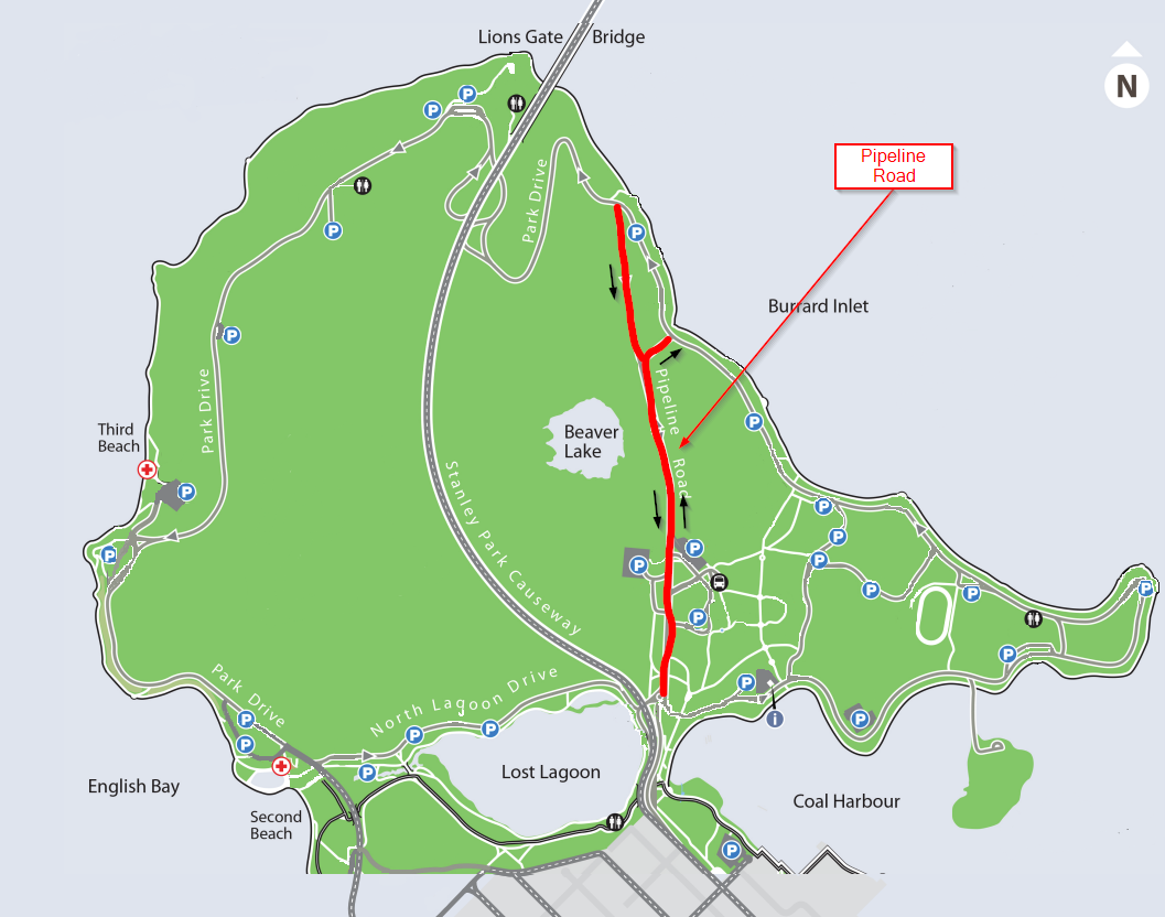
3 Pipeline Road
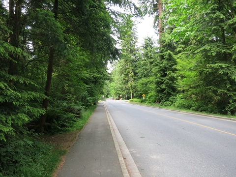
Pipeline Road serves as a critical cross-park shortcut, carving a path through the old-growth interior wilderness of the park.
Drivers utilize this track to quickly bypass the lengthy coastal perimeter loop when traveling directly between the south park entrances and the north cliff roads. It maps a straight path guiding visitors directly to the historic dining halls of the Stanley Park Pavilion, the family boarding terminals of the Miniature Train, and the forest trail networks encircling Beaver Lake.
The road yields rapid access to both the Stanley Park Junction Parking Lot and the Pipeline Road Parking Lot. Top features lining this route include the manicured rows of the Rose Garden and Shakespeare Garden.
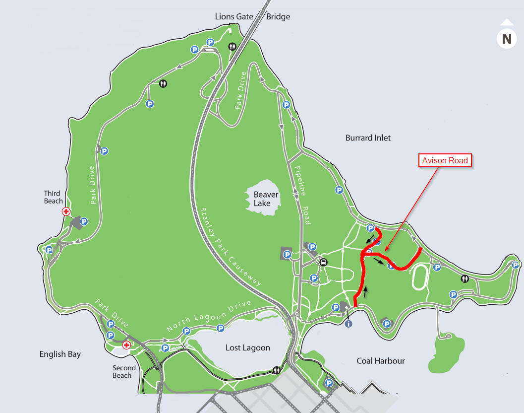
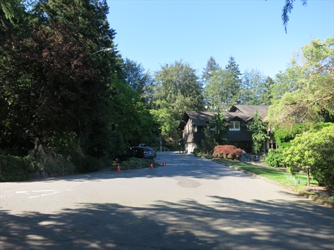
4 Avison Way
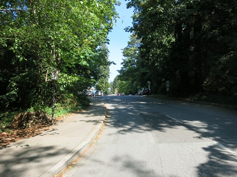
Avison Way cuts laterally across the eastern peninsula of the park, branching off immediately downstream from the primary Stanley Park Information Booth.
Its primary structural function is to safely funnel family vehicle traffic off the outer main loop and drop them directly at the doorsteps of the Vancouver Aquarium or the nearby sports fields of the historic Brockton Oval.
The road architecture perfectly interfaces with the high-capacity Vancouver Aquarium Parking Lot and the adjacent Brockton Oval Parking Lot grids.
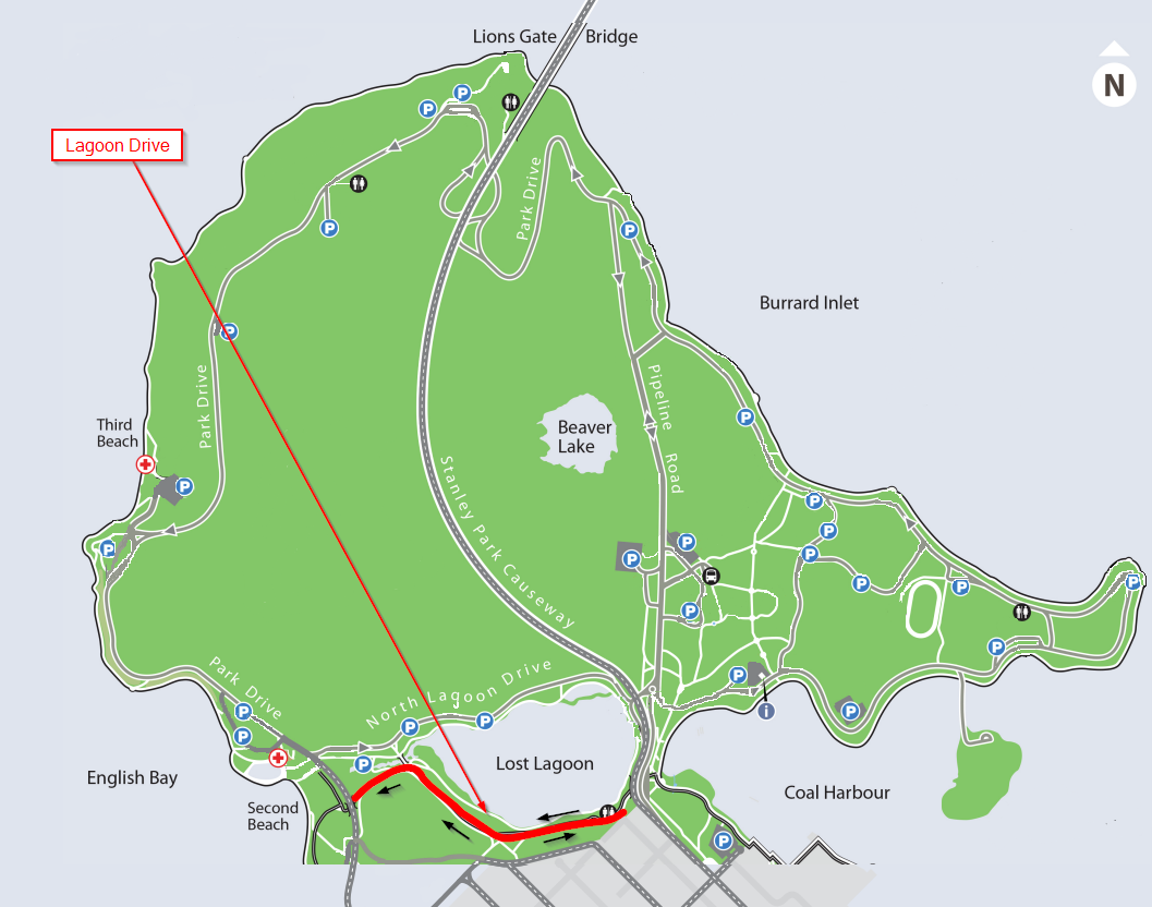
5 Lagoon Drive
Lagoon Drive loops out from the western residential termination grid of Robson Street in downtown's West End, hugging the outer banks of the park before merging directly with the perimeter flow of Stanley Park Drive.
This road guides visitors along the edge of the recreational Stanley Park Pitch and Putt Golf Course and passes the dedicated parking lot for the popular Stanley Park Brewing Restaurant and Brewery. Mapped spots lining this drive feature the local public tennis courts, the community flower plots, and the historic Queen Elizabeth Oak Tree and plaque.
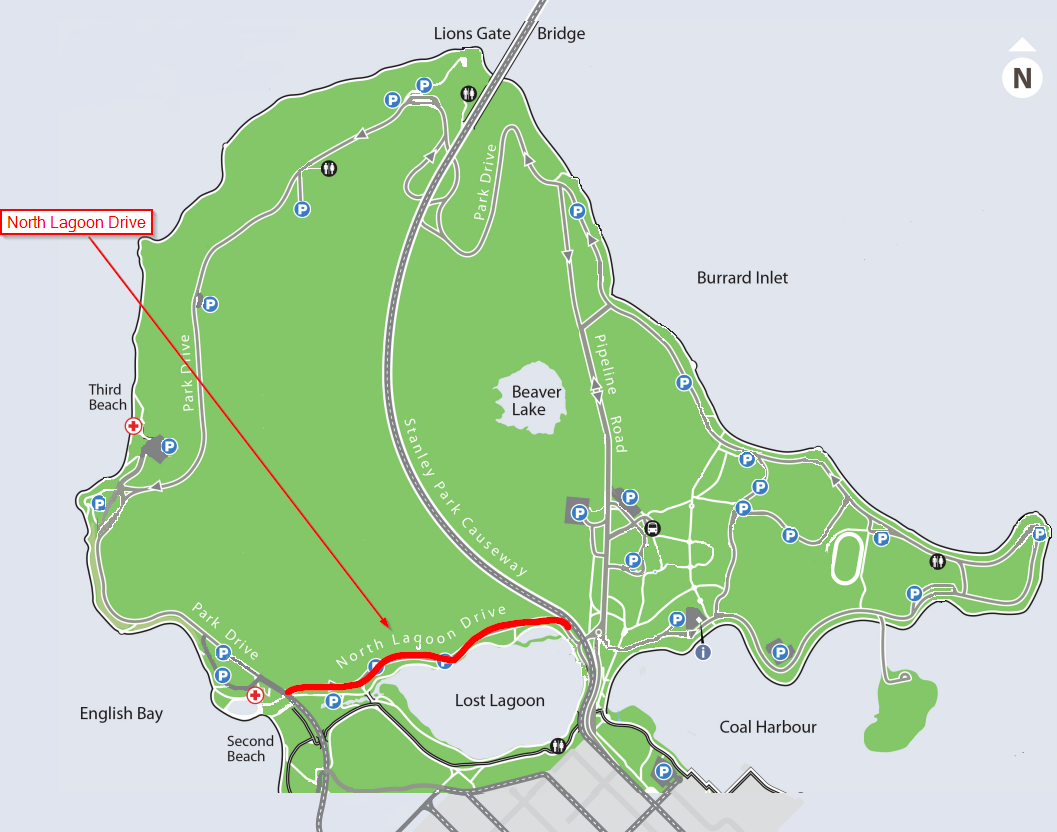
6 North Lagoon Drive
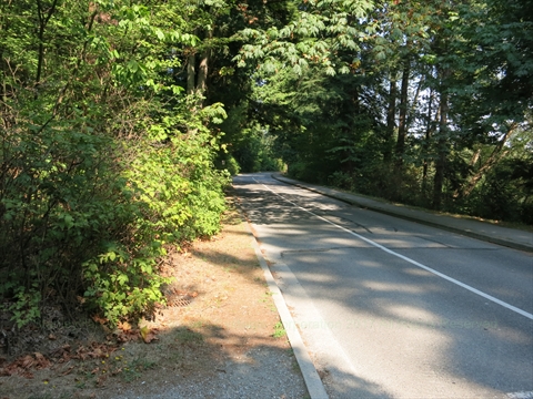
North Lagoon Drive extends as a designated one-way path tracking along the forested north bank of Lost Lagoon, bridging the distance from Ceperley Park over to the Causeway entrance.
The road acts as the primary vehicle exit routing for motorists seeking to leave the southern attractions of the park and escape back into downtown Vancouver. While the road contains no dedicated standalone parking lot loops, it features extensive parallel curbside street parking capacity along its entire forested length.
The road is bounded by deep woodland on both sides, but functions as a close staging point for the grassy expanses of Ceperley Meadow and the trail openings cutting north into the forest.
7 Park Lane

Park Lane is a short, specialized one-way operational connector link that transitions traffic between Stanley Park Drive and Lagoon Drive.
Its primary utility is granting direct vehicular drops to the administrative headquarters of the Vancouver Parks Board Office, the historic greens of the Stanley Park Lawn Bowling Club, and the sprawling West End public Tennis Courts. The road guides drivers straight through the core of the main tennis parking lots.

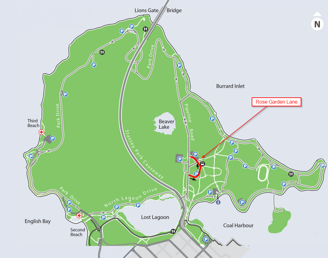
8 Rose Garden Lane
Rose Garden Lane is a short, scenic one-way crescent that loops off Pipeline Road, hugging the perimeter of the floral beds before reconnecting with Pipeline Road just past the train station.
This loop is specifically utilized by diners and theatergoers seeking front-door vehicle drops at the historic Stanley Park Pavilion and the outdoor stage gates of Malkin Bowl. It threads directly between the high-capacity Stanley Park Pavilion Parking Lot and the main Stanley Park Junction Parking Lot.
Attractions lining this short drive include the multi-tiered Rose Garden, the stonework monuments of the President Harding Memorial, casual dining at Stanley's Bar and Grill, the alpine mosses of the historic Rock Garden, the old stone Wishing Well, and the quiet paths of the Air Force Garden of Remembrance.